

Cardamom Rainforest & Conservation Corridor
- Expansive protected rainforest surrounding the camp, known for rich biodiversity and ongoing conservation work.
- Distance: ≈0–5 km (immediate surroundings)
- Mode: Guided walks, 4x4, boat; ~10–60 minutes depending on route
- Best time: Year-round; early morning and late afternoon for wildlife activity
- Tip: Join guided conservation or ranger-led activities for safer access and better sightings.
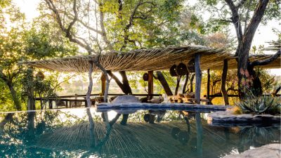
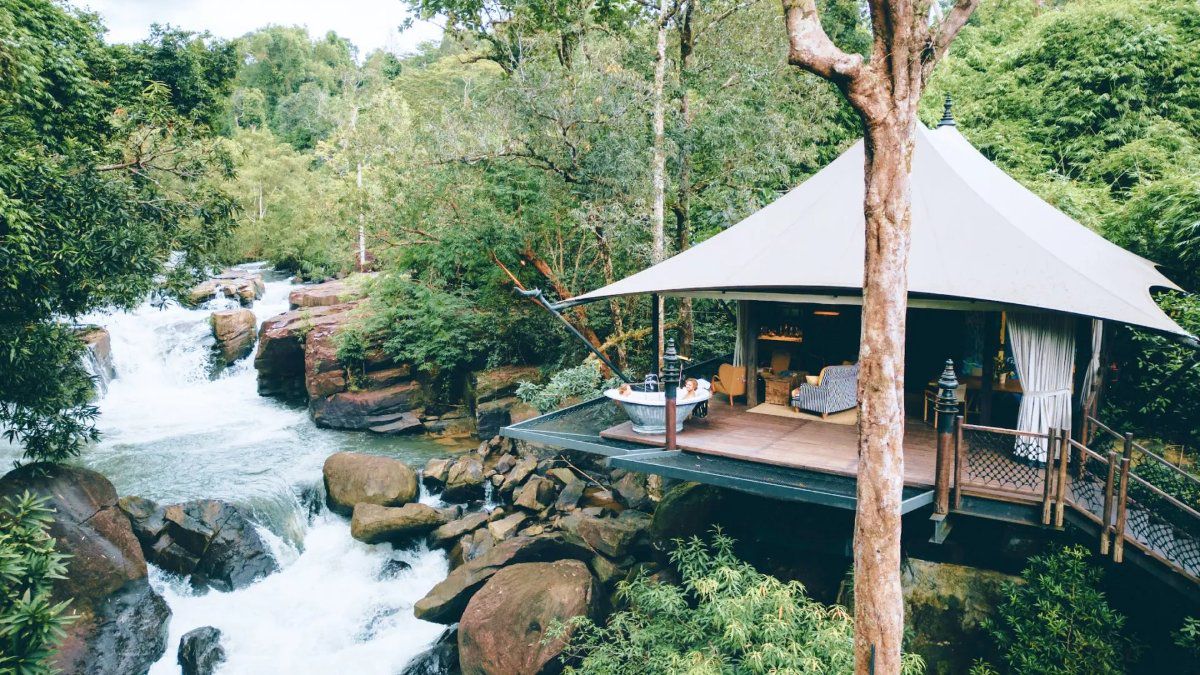
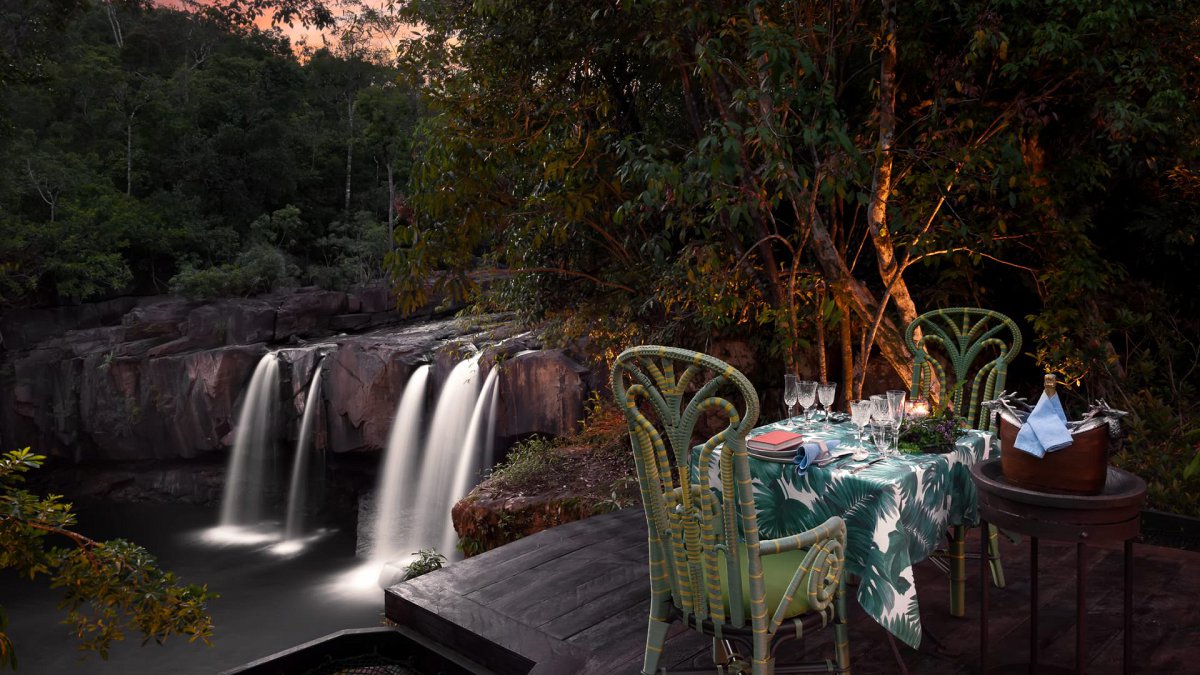
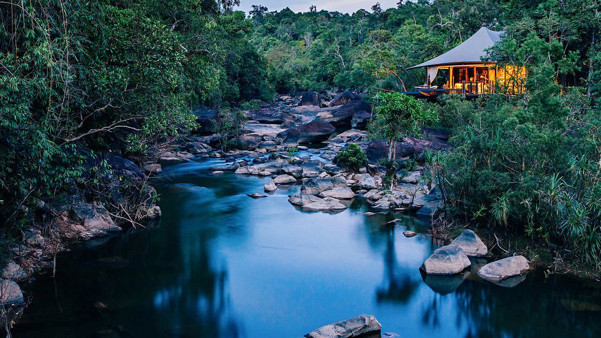
Tmor Rung River & Waterfalls
- Jungle river with natural pools and cascades, accessible directly from the camp area.
- Distance: ≈0–3 km
- Mode: Walk, zipline arrival, or boat; ~5–20 minutes
- Best time: Jun–Nov for fuller waterfalls; cooler light early/late in the day
- Tip: Use sturdy water-friendly footwear; rocks can be slippery after rain.
Kirirom National Park
- Cooler highland plateau with pine forests, viewpoints, and lakes on the park’s eastern side.
- Distance: ≈20–30 km
- Mode: Car/4x4; ~45–60 minutes (conditions permitting)
- Best time: Nov–Feb daytime for pleasant temperatures and clearer views
- Tip: Check track conditions in the wet season; a 4x4 is advisable.
Tatai River & Tatai Waterfall
- Lowland river and two-tier waterfall known for boat trips, swimming spots, and mangrove scenery.
- Distance: ≈80–110 km
- Mode: Car via Highway 48 plus short boat ride; ~2–3 hours (traffic and river conditions permitting)
- Best time: Jun–Nov for stronger flow; mornings for cooler temperatures
- Tip: Arrange boat access in advance through trusted operators for safety and timing.
Preah Monivong Bokor National Park
- Elevated national park with misty forests, cliff-edge viewpoints, and historic hill-station ruins.
- Distance: ≈120–160 km
- Mode: Car via Kampot/Bokor road; ~3–4 hours (traffic and weather dependent)
- Best time: Nov–Feb late morning–afternoon for higher chance of clear views
- Tip: Start early and carry layers; temperatures and visibility can change quickly on the plateau.
General Tip: Road and weather conditions in the Cardamom region can change quickly; allow buffer time, travel in daylight where possible, and confirm all transfers or excursions with the camp before setting out.